Author Topic: Swargarohini-Pandav went Heaven from here- स्वर्गारोहणी पांडव यही से गए थे स्वर्  (Read 20798 times)

एम.एस. मेहता /M S Mehta 9910532720

  • Core Team
  • Hero Member
  • *******
  • Posts: 40,912
  • Karma: +76/-0

Dosto,

Uttarakhand is known as abode of God & Goddess. There are several places which have relevance with great epics like Ramana & Mahabharata. The longs series not only guarding us but also connection with mythological stories.

It is said Pandavas' went Heaven from this Place.


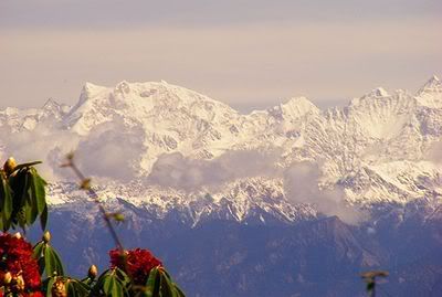
In this topic, we are providing some information about Swargarohini. Swargorhini derives it names from the Legends associated with that it peaks forms the path to heaven that was followed by Pandavas, Draupadi & their Dog.According to Legends its believed that is only way one can go to heaven with human body itself.

I am sure you will like information.

Regards.

M S Mehta

एम.एस. मेहता /M S Mehta 9910532720

  • Core Team
  • Hero Member
  • *******
  • Posts: 40,912
  • Karma: +76/-0

Our Member Tilak Soni has already visited and has provided this photo of Swargarohni

Satopanth -Swarga Rohini is a wonderful holy trek in the core Himalayas. the trek starts from Badrinath. Satopanth is around 30 kms and further 5 kms takes one to SwargaRohini.
the trek can be done in 4 days. many like to spend more time and enjoy Himalayas.
the trek is not hard till Satopanth lake.. the last stretch can be termed as a little tough for first timers.


एम.एस. मेहता /M S Mehta 9910532720

  • Core Team
  • Hero Member
  • *******
  • Posts: 40,912
  • Karma: +76/-0

एम.एस. मेहता /M S Mehta 9910532720

  • Core Team
  • Hero Member
  • *******
  • Posts: 40,912
  • Karma: +76/-0
(From -Adhiraj Deshpande) About Swargarohini Trek    Imagine yourself in a place surrounded by snow clad mountains on four sides, green grass and innumerable flowers with various colours and shades, a river, many small streams and a glacier flowing at some distance, no other human being in sight, no noise except that of flowing river and only a few birds and their chirping; sounds amazing? Thats exactly what we experienced during Swargarohini trek.Swargarohini is name for a path which Pandavas had traversed on their way to Heaven, when fully covered by snow it actually looks like staircase, thats why the name Swarga-Rohini. On 14th of July Poovaiah, Sathajit, Yatin and I reached Badrinath. We stayed there for 1 complete day to get aclimatized to high altitude. The trek started next day from a small village called Mana (Altitude of 3,000 meter) around 3 Km from Badrinath. On the way of the trek there is no town or hotel or any human residence around hence we had to carry many items like tents, mats, sleeping bags, food items, stove to cook, fuel etc and thus we decided to take 4 porters along with 1 guide making our team of 9. To describe the complete experience and thrill in words is very difficult for me but i have tried my best with the assistance of a tool which is famous as something which speaks thousand words, thats right Photos. The link to the associated photos are given wherever needed, it is recommended see those photos parallely to get a feel. To see the complete album clickhere.
 
 
Day 1#  Mana to Lakshmi Ban (8 Km):Our plan to start trekking at 7AM was little delayed by the morning showers, so we started at 9AM and crossed the small wooden bridge on Alaknanda river. Rest of the trek was on one side of Alaknanda river. At some places it was dangerous to walk because of sloping mountain on one side, river a few hundreds of meters down in the valley roaring and just enough space to keep 1 foot at a time. Initially adog accompanied us for a while, the legend goes that whoever goes for this trek is always accompanied by dogs. On the way we spotted two Himalayan crows. At Lakshmi Ban we saw Bhoj trees, these tree's skin was used to write Ramayana in olden times. The view from Lakshmi Ban was amazing, we could see the unionof two rivers Alaknanda and Alkapuri. We set up tents there and relaxed. At around 8.30 PM it was almost dark and the sky was clear. No clouds, no light from street lamps to hinder the view, the only light was the moon light reflected from snow around. Because of very clear sky we could see innumerable stars and also many falling stars, after some time when moon rose the view of moon and venus seen next to dark mountains was breathtaking. Unfortunately on all the other nights sky wasn't clear and we couldn't see this view twice.Day 2# Lakshmi Ban to Chakrateerth (13 Km):On the way to Chakrateerth we saw Sahastradhara falls, the point where a glacier becomes river. This patch of the trek was comparatively easy. Chakrateerth is a very nice place for camping. A flat ground in the middle of rocky mountains covered with grass and flowers. A stream flowing on the sides carrying pure, cool and sweet water. Water is another unique feature I liked about this trek. The water we drank during the whole trek was taken from the streams flowing nearby the places of camping. It was really pure and its taste is something I cant explain in words, it was simply superb. Day 3# Chakrateerth to Sathopanth lake (4 Km):After getting used to the climbing and climate in last 2 days we planned and managed to go only 4 km on 3rd day. The reason was the terrain was full of boulders. One has to be very carefull while walking in boulder zone. We reached at Sathopanth lake in afternoon and camped there. Sathopanth lake is traingular in shape. We took a dip in its water, it was freezing cold. In the evening we went to the icy place which was feeding water to lake.Day 4# Sathopanth to Swargarohini base to Sathopanth (16 Km):We started early in the morning as we were going without tents and porters and had to be back to Sathopanth camp before evening. The evenings in this part of Himalaya are very unpredictable, it can rain or the whole place can get covered with thick fog making it impossible to see around and thus walk, fortunately nothing like this happened. On the way we saw Surya kund. After walking 8 Km really fast we reached the base of Swargarohini, the last point of our trek. From this point we could see the way to heaven in front of us. It was very much tempting to continue further and see what lies beyoond it (the legend says only Yudhishtir could cross this last part of the way to heaven) but the distance (around 100 Km but looks very close) and difficulty of the terrain would mean a sure way to heaven :) After enjoying the magnificent view around we started walking our way back to the camp at Sathopanth lake. Day 5# Sathopanth Lake to Mana (25 Km):We started walking determined to make it to Mana before the end of the day. We took fewer and shorter stops and covered 16 Km really fast. It had rained a lot previous night causing the water in all the strams we crossed on our way up to increase to a dangerous level making them very difficult to cross. We managed to cross all the streams somehow but we got struck at the last stream which had a scary flow. One more tour group was struck at the other end of the stream. With the help of porters from both the groups we managed to cross this last hurdle but it took 1 hour. Again we walked really fast, it was drizzling so we had to take out plastic covers, the night was approaching fast. At around 7 PM we reached at the base of Mana and now had to cross the river Alaknanda which had expanded a lot and was flowing around the small wooden bridge. Crossing this river took 5 minutes and the water was deadly cold. Finally passing through all this when we reached Mana it was complete dark. We completed the trek safely. The experience was surely a lifetime experience. Himalaya is one of the most beautiful places on earth, a must visit for everyone. I decided to go there many times in the future.


एम.एस. मेहता /M S Mehta 9910532720

  • Core Team
  • Hero Member
  • *******
  • Posts: 40,912
  • Karma: +76/-0
 photo  Panoramic view of Swagarohini Group  and Dhodu from south side of Ranglana

Devbhoomi,Uttarakhand

  • MeraPahad Team
  • Hero Member
  • *****
  • Posts: 13,048
  • Karma: +59/-1
The swargarohini path which Yudhishtara is assumed to have climbed is on the side of Chaukumba - it is the Tilman route to Kedarnath. I hope that the Badrinath - Kedarnath trek route will be established soon. The traffic in Satopanth has increased in 2006 and due to the nuisance the Saints meditating in Satopanth are planning to relocate up.

Devbhoomi,Uttarakhand

  • MeraPahad Team
  • Hero Member
  • *****
  • Posts: 13,048
  • Karma: +59/-1

Devbhoomi,Uttarakhand

  • MeraPahad Team
  • Hero Member
  • *****
  • Posts: 13,048
  • Karma: +59/-1


Sitemap 1 2 3 4 5 6 7 8 9 10 11 12 13 14 15 16 17 18 19 20 21 22